Drones Power Community Wildfire Protection: A Practice in Waikōloa, Hawaii

 In Waikōloa Village, Hawaii, Matt Chalker is a passionate advocate for wildfire safety. He co-founded the Wildfire Safety Advocates of Waikōloa (WSAW), a grassroots movement dedicated to protecting the community from wildfire threats. With a deep connection to the land and a background in community service, Matt has revolutionized community safety using drone technology.
The Critical Role of Drones in Wildfire Prevention
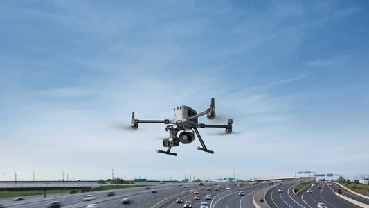
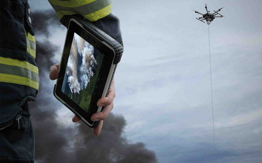
Drones have become an indispensable part of WSAW’s efforts, offering a unique perspective on Waikōloa and its landscapes. By documenting wildfire hazards from above, these technologies have raised awareness of existing threats and accelerated the implementation of safety plans.
“During the largest wildfire in Hawaii’s history in 2021, which came within three miles of our home, we were forced to evacuate with our one-year-old child,” Matt recalled. “These events had a profound psychological impact on me. Although we’ve been fortunate to avoid disaster, our community has been overlooked for too long. I decided to start documenting our situation through video as a form of therapy. If a picture is worth a thousand words, a video is priceless.”
The Mission and Challenges of WSAW
Founded in early 2024, WSAW aims to address the critical need for a second road in the community. With approximately 7,400 residents, Waikōloa Village is in one of the state’s highest wildfire risk areas and currently has only one road in and out. Despite government committees identifying the need for a second road over 20 years ago, no progress has been made.
“We realized that what’s truly needed is advocacy,” Matt said. “We’ve turned up the volume to draw the attention of decision-makers, private landowners, and governmental entities to make wise decisions about our community’s safety.”
Applications of Drone Technology
Drones have played a vital role in identifying high-risk areas and mapping vulnerabilities. By publicly posting aerial footage of these areas, drones have expanded awareness of these hazards beyond those who live adjacent to them.
“For example, there are several internal lots in the village that have historically been unmaintained and used as dump sites, creating fire hazards,” Matt explained. “Aerial footage from drones has accelerated plans to clear and maintain these lots.”
Looking to the Future of Drone Technology
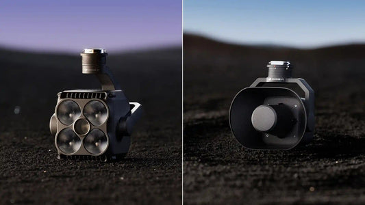
As technology continues to advance, innovations like thermal imaging drone payload and LiDAR drone mapping are transforming the landscape. Thermal imaging drone payload can detect heat signatures invisible to the naked eye, helping identify potential fire hotspots. LiDAR drone mapping offers a new way to create detailed topographic maps, which is invaluable for assessing wildfire risk zones.
Additionally, the growing market for buy drone payload for inspection and specialized drone payload integration services provides wildfire prevention organizations with more options. These services ensure that drone payloads are seamlessly integrated into existing systems, enhancing operational efficiency.
“The progress in drone technology offers our community a safer and more resilient future,” Matt stated. “With these technologies, we are better equipped to protect our homes and community.”